

Features Land Area
Measure land area1.
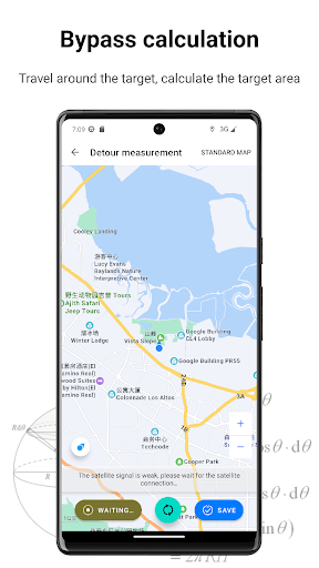
Detour measurement - detour around the target and automatically calculate the size of the target area;2.
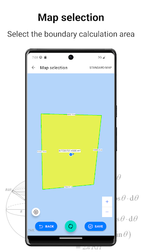
Map selection - Long press the map to select the target boundary point to calculate the size of the target area;3.
Straight line distance measurement - select the map or position to obtain the starting point, and then calculate the real distance between the two points;4.
Area Calculation - supports display of various units, such as mu, cent, centimeter, hectare, hectare, acre, nautical mile, inch, inch, kilometer, kilometer and other units.5.
Map type - standard map and satellite map;6.
History record - record the measurement history, which is convenient for subsequent viewing and use.
Gaming Features
Enjoy immersive gaming experience with various game modes.
Travel Features
Plan and manage your travels with ease.
Automotive
Manage and monitor your vehicle with smart features.
See the Land Area in Action
Get the App Today
Available for Android 8.0 and above